Satellite and Radar Applications
Satellite observations are nowadays routinely used in weather forecasting and climate research, as visual aids for forecasters, as input information for the weather models, and as data sources against which climate models may be compared. Part of the information in satellite observations describes the state of the atmosphere such as: cloud cover, water vapour, aerosols (such as volcanic ash), trace gases, as well as wind speed and direction. Many satellite observations also characterize the surface conditions of the globe: surface temperature, surface albedo, snow cover, glaciers, sea ice, wave height, pollution of water (such as oil spills), soil moisture, biomass, leaf area index, forest or brush fires etc.
FMI participates in and contributes to EUMETSAT Satellite Application Facility (SAF) projects CM SAF and H SAF. CM SAF focuses on the provision of satellite-based data in support of climate research of the Earth’s water and energy cycles, whereas H SAF focuses on provision of satellite-based data to support hydrological research.
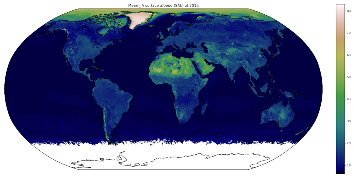
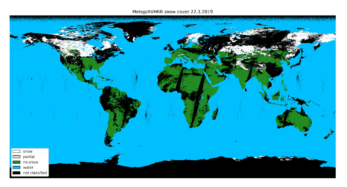
In CM SAF, FMI is responsible for the provision of a global surface albedo dataset, based on polar-orbiting weather satellite observations from NOAA POES and EUMETSAT METOP series of satellites carrying the AVHRR imager. In H SAF, FMI develops a variety of datasets describing the extent and properties of both European and global seasonal snow cover. Our team actively develops state-of-the-art algorithms towards these ends, taking advantage of advances in e.g. machine learning.
Our research group focuses on the current state and future development of seasonal snow cover across the Northern Hemisphere. Research based on remote sensing has been funded by the Research Council of Finland through the projects CRYO-TREC (2017–2021) and SNOCAP (2021–2025). In these projects, we have developed computational methods to estimate snowfall by combining satellite and radar observations. These methods are now being further refined for practical application across the entire Eurasian region. Other key research themes include the impact of changes in snow and ice reflectivity on the Earth’s energy balance, as well as Antarctic research, with particular emphasis on changes in energy and mass balance in Queen Maud Land. The Antarctic projects LAS3R (2021–2024) and EXQALIBR (2025–2028), funded by the Research Council of Finland, include extensive field measurement campaigns at Finland’s Aboa Research Station, focusing on the physical properties of snow and ice cover. Our group is strongly engaged in international collaboration. We participate in activities of the European Organisation for the Exploitation of Meteorological Satellites (EUMETSAT) and in research programmes of the European Space Agency (ESA). In addition, we collaborate internationally, particularly in the study and determination of snow, ice and sea ice albedo.