Buoys observe the sea
Buoys are used in the sea as platforms for different instruments that measure the sea. Buoys can be anchored to a certain location, or they can float freely along with water or ice.
The Finnish Meteorological Institute has operative wave buoys that measure waves, sea surface temperature and -currents, and buoys that measure only the sea surface temperature. Some of them measure also air temperature. The observations from these buoys are available in different channels, like at the web site and in the open data. The data is transformed from the buoys in the sea to land via a satellite connection, mobile network, or a HF-radio link.
In research use FMI has buoys that float in water or with the ice, diving Argo-buoys and buoys fixed in one place. The data from these buoys is usually not public, because the time series are quite short, but they can be used in research projects. Most often the buoys measure temperature and salinity of the sea water, but also instruments measuring the concentration of oxygen or CO₂, or bio-optic parameters of the seawater may be installed to the buoys or hanging below them. Floating buoys provide data about the movements of water and ice.
Wave buoys
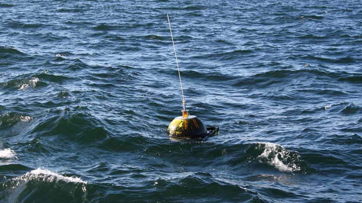
The Finnish Meteorological Institute measures waves during open water seasons in the Finnish sea areas. The wave buoys have a diameter of 0.7 or 0.9 meters, and they are anchored to sea so that their movements follow the waves freely. These Directional Waverider® wave buoys measure the waves with three acceleration sensors and a compass. One of the sensors measures the buoy’s vertical acceleration and the two others measure horizontal acceleration. This way the waves’ height, period and direction can be measured. The buoys also measure water temperature and currents.
The observations are sent via an Iridium satellite or via radio to the receiving station.
The Finnish Meteorological Institute also uses small DWR-G4 buoys that are based on GPS-technology. They can be used in temporary measurements as freely floating or anchored. The research vessel Aranda makes wave measurements with capacitive wire sensors, wave radar and air photographing.
Buoys measure the waves, depending on the buoy, for 1600 or 1800 seconds (that is about half an hour) and then calculate a spectrum from the time series. The basic parameters of the waves are calculated from the spectrum. The data is sent forward every half an hour. The timestamp in the measurement data tells when the 1600 or 1800 second’s time series started.
The parameters available from the data:
Significant wave height.
Highest individual wave.
The (modal) period of the peak: the period with the largest energy.
Direction: the direction waves come from at the point of the peak’s period.
The distribution of the direction: the distribution of the direction at the peak’s period.
Water temperature: measured 0.35-0.45 meters below surface.
Current speed.
Current direction.
Sea surface temperature buoys
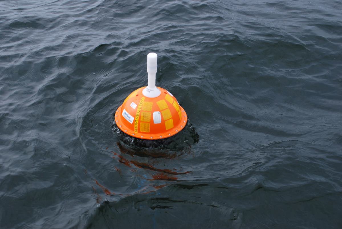
Sea surface temperature (SST) is measured during open water season alongside the Finnish coast with sea surface temperature buoys. They are anchored in places sheltered by the outermost islands and skerries, where is no boat traffic and the measured temperature represents the conditions of a larger area.
The buoys send the temperature observation and their location every hour to land via an Iridium-satellite. The measuring depth of the temperature is a little less than 20 cm. The measurements were started in 2016.
The buoys are iSVP-buoys by MetOcean, which have been modified for anchoring. The sensor is made by U.S. Sensors and, according to the manufacturer, its accuracy is 0.05 °C. Based on comparative measurements the actual accuracy is estimated to be around 0.2 °C.
They buoys are orange and they have a white, antenna-like part. The diameter of the buoy is around 35 cm and on the surface there’s a nametag (the name format is SST_) and reflector bands. They are named after a town and an island or a skerry nearby.
2.9.2025
