Meteorological physical quantities: what do we observe?
Surface weather observations are performed extensively in all of Finland. The weather observation network consists mainly of automatic observation stations, but some of the meteorological physical quantities are also measured manually, by a person, once a day.
Weather observations are produced according to World Meteorological Organization (WMO) regulations (WMO-No.8, CIMO Guide).
Temperature
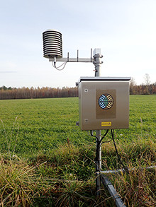
Air temperature is measured at a height of two meters. The probe is situated inside a well-ventilated radiation shield, which gives cover from direct sunlight and rain.
Temperature is also measured near the surface of the ground. This is called measuring the surface minimum temperature. The automatic measurement is done during the summer season at a height of 5 cm on an artificial grass or cut grass area. The probe is lifted above the snow during the winter season and is placed at a height of 5 cm above the snow. The probe is lifted above the snow every time after snowfall. The measuring principle is the same as with the two-meter temperature measurement. The surface level temperature probe needs to be in an open space, so that the heat radiation leaving the ground is not obstructed and the measurements are representative.
Atmospheric pressure
Atmospheric pressure measurements are performed with a pressure gauge. The atmospheric pressure measured at the weather station is arithmetically converted (reduced) to sea-level altitude, which makes measurements done at different weather stations comparable with each other. Before the automation of atmospheric pressure measurements, the readings were done manually from a mercury barometer.
Humidity
The relative humidity of the air is measured with a probe situated inside a radiation shield together with the temperature probe at a height of two meters. Other quantities related to humidity, such as the most frequently used dew point, are derived mathematically from the relative humidity. Humidity was measured earlier in a wooden booth together with the temperature. The relative humidity was determined manually with a so called wet-and-dry-bulb thermometer (psychrometer) or a hair tension hygrometer. The dry temperature was read of a regular thermometer. The wet thermometer was like the dry one, but its liquid bulb was covered with a damp cloth and it was ventilated to evaporate the moisture. With the help of these temperature readings it was possible to look up the humidity off a chart or by calculating it. The mechanical hair tension hygrometer indicated the relative humidity directly as a percentage, which was based on a hairs ability to change its length according to the relative humidity of the air.
Wind
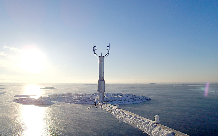
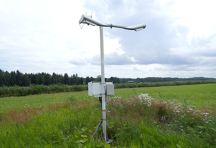
Wind speed and direction are measured at the weather station with an acoustic anemometer, or with a weather vane and a cup anemometer. An acoustic anemometer consists of three to four ultrasonic transducers that work as senders and receivers. The sound travels through the air and based on that it is possible to calculate the wind quantities. The speed of sound is dependent on the air temperature. Regular wind measurements are done through hourly and ten-minute averages. A three second maximum gust measurement is calculated from the regular wind measurements (maximum three second average on a ten-minute period). Wind direction and speed is measured at an altitude of ten meters above the ground surface, above major obstacles near the station. Because of this, the measuring altitude changes depending on the weather station. Challenges for wind measurements are:
changes in the observation environment
observation sensitivity at low wind speeds with a cup anemometer
freezing conditions in the winter
obstacles at certain measuring directions
damage caused by birds
Challenges are reduced by planning, technical solutions and by appropriate maintenance and quality control processes.
Before the era of automatic wind measurements, wind direction and speed were measured by a human with the help of a weather vane (Wild vane). This method was far more inaccurate than modern automatic observations, because it was based on observing the direction of a mechanical vane and the position of a flange for wind speed.
Solar radiation
The most central quantities of solar radiation are global radiation, UV-radiation and amount of sunlight. Global radiation, also known as total radiation, is the measurement of shortwave broadband radiation (W/m2) that meets the probe from across the entire firmament.
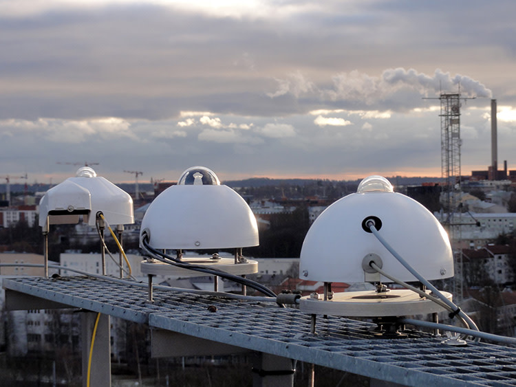
Ultra-violet radiation is usually reported as a UV-index (UVI). Sunshine is reported when the intensity of the radiation from the direction of the sun is at least 120 W/m2. This results in a measurement reported as the total duration of sunshine. Other radiation measurements are also done, for example direct solar radiation, diffuse radiation, reflected solar radiation, downward terrestrial radiation, outgoing longwave radiation and net radiation.
Present weather and visibility
A manual visibility observation was always conducted as an optical observation in the past. The observer used objects at a known distance as reference points. The optimal observation point was at an open spot with a view in every direction and good reference points such as chimneys or the edge of a forest. If it was possible to barely see the reference point, then that would be the current visibility in that direction. If the visibility was different in different directions, the lowest visibility was reported. The manual method of observing visibility is still used at some observation stations.
The automatically observed meteorological visibility is not dependent on the amount of light. The visibility and present weather sensor functions based on measuring the amount of scatter by emitting infrared light. An optical sensor of this kind has a transmitter and a receiver. The higher the number of raindrops, ice crystals or other particles (such as rain, snowfall, dust, smoke) there are in the air, the more of the transmitted light is scattered to the receiver. The optical sensor then calculates the visibility at that point, and the present weather based on the scatter information (for example state of the precipitation). The following weather phenomenon's among others are reported by the sensor: mist, fog, drizzle, rain, snowfall, sleet, showers, snow flurries and thunder.
Clouds
The cloud amount is measured automatically with a cloud height meter, also known as a ceilometer. A ceilometer measures the cloud amount with a thin vertical laser beam vertically above the sensor. The beam has a diameter of about 4 meters at an altitude of 5 kilometers. The ceilometers currently in use can measure clouds up to an altitude of 7,5 kilometers. The cloud amount algorithms can identify up to four different layers of clouds, depending on the thickness of the lower cloud levels. The total amount of clouds is estimated by combining cloud data from the last 30 minutes. Due to the thin beam from the sensor, the cloud amounts can be different from an optical observation done manually. Heavy rainfall can also disturb cloud measurements.
Before automated cloud observations were possible, the cloud amount was reported through an optical observation. It was reported by dividing the sky in to eight parts, and the total amount of clouds was the sum of all cloud-covered parts of the sky in oktas (parts of eight). Cloud heights were estimated mainly by recognizing the cloud by type, although the height of low clouds could by calculated at night trigonometrically with the help of an angle meter and a light beam that was reflected of the bottom of the cloud.
Precipitation
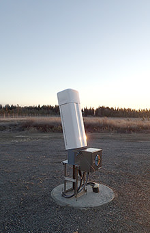
Automatic rain gauges, also known as pluviometers, are weight scales. The measuring of precipitation is based on weighing the mass of the liquid precipitation in the pluviometer, which is then mathematically converted into millimeters. An automatic pluviometer reports the amount of precipitation every hour, and a 12-hour and 24-hour accumulation is calculated by summing up the last hourly measurements. The pluviometer can also produce data of the intensity of the precipitation. The pluviometer is protected from the wind by using a wind protector around the gauge. The wind protector is useful especially during snowfall, as the protector stops the lightweight snowflakes from traveling past the pluviometer opening. The pluviometer is equipped with a defrost liquid during the winter, to properly observe snowfall amounts. The opening of the pluviometer is also equipped with a heater, so it doesn't get filled with snow during heavy snowfall. The opening of the pluviometer is placed at a height of 1,5 meters. An optimal place for the gauge is where possible obstacles are at a distance twice their own height from the observation spot.
Snow depth
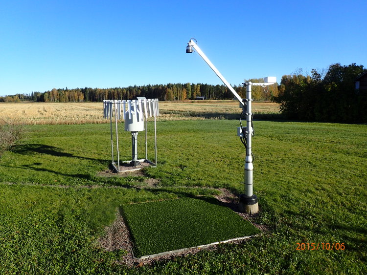
Snow depth is measured automatically with an ultrasound snow sensor. The snow sensor is pointed straight down, and it measures the distance between the transmitter and the top of the snow. The ground under the snow sensor is a flat surface with artificial grass as the base material. The artificial grass keeps the ground flat and stable. The snow sensor is set at a standard height off the ground, and once the distance between the sensor and the ground decreases, the difference is reported as the snow depth. Due to the observation method, strong drifting of snow, litter on the observation site, ground frost and animals can cause disturbance with the measurements. The disturbances are avoided by using technical solutions and by maintaining the observation site properly. The distance between the spot of measurement and the nearest obstacles or plants should follow the same principle as with precipitation measurements, therefore they should be at least twice the distance of their height away from the observation spot. The measurement is done at a single point, so the snow depth can differ from the regional average.
