Sodankylä Supersite
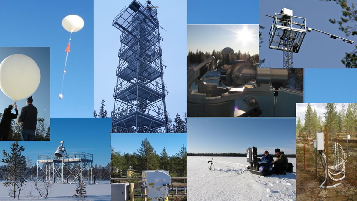
The Sodankylä Supersite accommodates a unique integrated observation system that monitors the interaction between the Earth’s surface, biosphere and the atmosphere employing a suite of automated sensors and manual monitoring programs.
European Space Agency and FMI have established the “ESA-FMI Arctic-Boreal Earth Science, calibration and validation supersite” in Sodankylä in 2025, developing Sodankylä infrastructure for satellite cal/val activities in the Arctic-Boreal zone. More information about the ESA Sodankylä supersite.
Field observations are accompanied by reference instruments of various currently operational or planned Earth Observation (EO) satellite sensors by
European Space Agency (ESA), The National Aeronautics and Space Administration (NASA), European Organization for exploitation of Meteorological Satellites (EUMETSAT), Canada, Italy, Japan, and China
The Sodankylä infrastructure is a critical gap filler concerning the investigation of Earth System at the high latitudes, as it provides reference data for satellite observations
Platform for ESA and NASA
The Sodankylä Supersite is an essential platform for ESA and NASA to develop products and the scientific end-use of data from such globally essential environment and climate monitoring satellites
NASA OCO2 (atmospheric CO2 concentration)
ESA TROPOMI/Sentinel 5 Precursor (atmospheric methane and CO, ozone and solar UV radiation as well as short-lived air pollutants)
ESA SMOS (Soil Moisture and Ocean Salinity Mission and NASA SMAP mission (Soil Moisture – Active and Passive).
Sodankylä Supersite accommodates the reference instruments of NASA and ESA satellites on a permanent basis providing vital information for the utilization of mission data and for the development and validation of satellite products on geo- and biophysical variables (satellite calibration and validation, CAL-VAL). The Sodankylä site is also a test bed for several recently proposed satellite missions.
International Research Infrastructure Networks
An exceptional feature in Sodankylä infrastructure is the integrated monitoring of boreal/sub-arctic environmental and climate processes from below the surface to upper limits of atmosphere and to space weather phenomena. FMI Sodankylä infrastructure serves as a primary station of numerous international research infrastructure networks, such as
WMO Global Atmosphere Watch (GAW)
WMO Global Cryosphere Watch (GCW)
NASA/JPL/CalTech led TCCON (Total Carbon Column Observing Network)
European Integrated Carbon Observation System (ICOS)
GCOS Reference Upper-Air Network (GRUAN)
Sodankylä facility is also a partner of the EU-funded International Network for Terrestrial Research and Monitoring in the Arctic (INTERACT) and of the University of the Arctic. Further, in 2018 FMI and the University of Oulu established the Sodankylä Space Campus to utilize the infrastructure of the two institutes in Sodankylä for multidisciplinary research and educational purposes.
Sodankylä Supersite Topics
Further information on observations is available at http://litdb.fmi.fi and http://nsdc.fmi.fi. During the recent years the Sodankylä Supersite has experienced large expansion from 160 individual instruments/data sets in 2010 to over 450 in 2019. The data from Sodankylä measurement programs are used widely by different international research communities representing e.g.
Biology/ecosystem analysis/modelling
Hydrology
Greenhouse gas exchange research
Meteorology including development of numerical weather prediction
Climate change research
Development of weather-related applications in intelligent traffic
Atmospheric processes research (troposphere, stratosphere, mesosphere and ionosphere)
Space weather research
The Sodankylä Arctic Space Centre (FMI-ARC) is Finland’s primary infrastructure for the reception, utilization, calibration and validation of satellite data and products obtained from Earth Observation (EO) satellites. FMI-ARC also incorporates the National Satellite Data Centre (NSDC) and the Sodankylä Supersite, see also FMI-SPACE for more information.
