Pallas fells - topography, climate and history
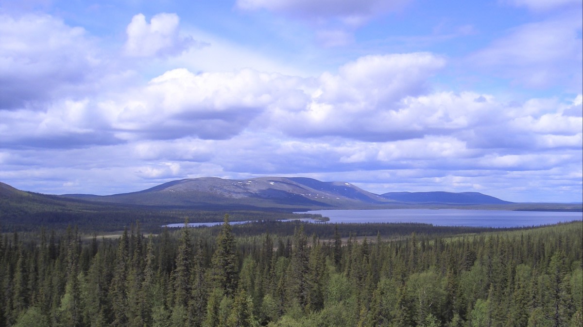
The fells on the Pallas area rise to an elevation of 500–800 m above sea level; the highest summit, Taivaskero, reaches 809 m a.s.l. They belong to the 50 km long fell chain of Pallas-Ounastunturit. Lake Pallasjärvi, which drains to the Baltic Sea via the rivers Ounasjoki and Kemijoki is the largest lake with an area of 17.3 km². The mean and maximum depth of Pallasjärvi is 9 and 36 m, respectively. The Keimiötunturi, Sammaltunturi and Pallastunturi fells are composed of mafic volcanic rock types, thus giving rise to nutrient rich soil conditions on the fell slopes. The treeline conifer species is Norway spruce, which is found at 457 m a.s.l. on the Lommoltunturi fell and at 530–548 m a.s.l. on Keimiötunturi. In contrast, the treeline conifer on the nutrient poor felsic Ounastunturi fells is Scots pine at 360 m a.s.l. As a consequence of the warmer climate in the region since the 1920s, a significant shift of spruce has occurred such that the tree line has extended by 55 m in elevation in 60 years.
According to the Köppen climate classification, the Pallas region is located at the edge of the northern boreal and subarctic climatic zones. The winters are cold and the summers short and cool with long-term monthly mean temperatures of –14°C and +14°C in January and July, respectively. The long-term annual mean temperature (1981–2010) measured at the Alamuonio weather station located ca. 35 km west of Pallas is –1.0 °C. The average peak snow depth reaches 73 cm and is typically observed during the latter half of March.
The Pallastunturit area was designated a National Park in 1938. While the National Park initially covered the Pallas-Ounastunturi region, it was expanded to include the southern fell area of Yllästunturit as well in 2005. The Pallas-Yllästunturi National Park currently covers an area of 1020 km2. To mention a fascinating historical anecdote, on July 6, 1952, the Olympic flame ignition for the Helsinki Olympic Games took place at the summit of the Taivaskero fell.
Pallas can be considered to also lie on the border of anthropogenic influences: to the south there is densely populated continental Europe, while to the east and north there are mainly large, sparsely populated areas dominated by tundra and the Arctic Ocean, respectively. Although the first air quality measurements at Pallas were motivated by the industrial emissions from the Kola Peninsula, Russia, the area is one of the least polluted parts of continental Europe and thus, the data from the Pallas sites are often considered to represent "background conditions".
The Finnish Meteorological Institute has a long history of atmospheric monitoring at Pallas. The first weather station ‘Pallasjärvi' was established near Lake Pallasjärvi in 1935 with three daily weather observations. The operation of this station ceased in 1972, four years after the retirement of Mr. Viljo Pakasmaa, the station manager and the park ranger of the Pallas-Ounastunturi National Park. The only significant gap in the observation records between 1935 and 1972 was from the autumn of 1944 to the winter of 1946 as the residence of the park ranger at Pallasjärvi was destroyed in the final stages of World War II. The weather station was in operation again from 1996 until 2002, when the measurements were moved to the newly established Kenttärova station. Nowadays the area comprises five official weather stations: Matorova (established in 1995), Laukukero (1996), Sammaltunturi (1996), Kenttärova (2002) and Lompolonvuoma (2013).
