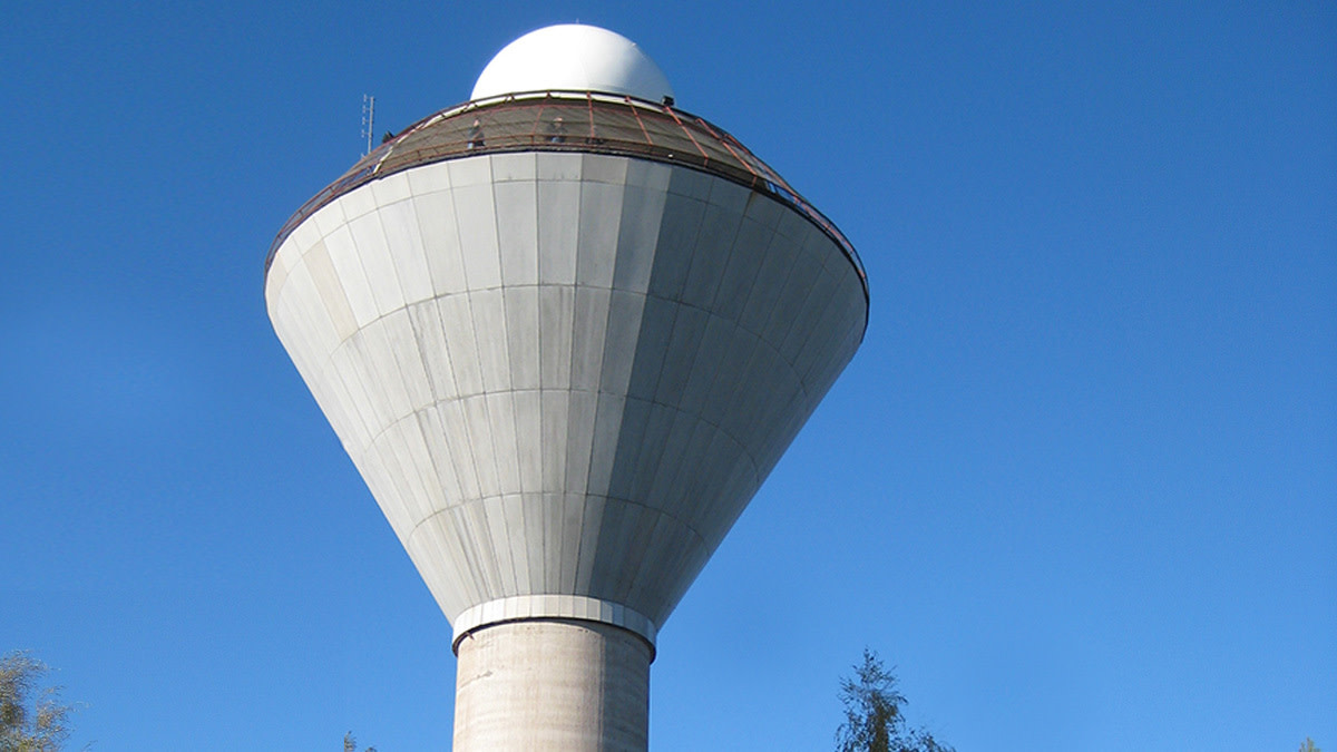
Ikaalinen weather radar to be transferred to Kankaanpää

The Finnish Meteorological Institute’s weather radar located at Ikaalinen water tower will be moved approximately 30 kilometres west to Kankaanpää during the spring and early summer. The dismantling of the radar equipment in Ikaalinen water tower will begin after Easter. Due to the transfer, weather radar output in the area will be interrupted for approximately two months.
“Construction work on the Kankaanpää radar tower is currently underway, and the new weather radar tower will be completed in early June. The aim is to get the weather radar output of the Kankaanpää area up and running well before Midsummer,” says Researcher Mikko Kurri from the Finnish Meteorological Institute.
The relocation of the weather radar is a result of the renovation work starting at the Ikaalinen water tower.
Minor effects on rainfall observations and weather forecasts
The pause in radar image output will have the most impact on the west coast, where the coverage of the radar network will not extend as far out to sea as during normal conditions. The temporary lack of data from the Ikaalinen radar will particularly affect observations of low-level and weak precipitation. The impact will not be very noticeable in summertime, however. The nearest radars, in Vimpeli and Petäjävesi, provide good detection of precipitation areas and weather phenomena at an altitude of more than 2.5 km, and reasonably good detection of precipitation areas and weather phenomena at a height of more than 1 km.
Measurement data obtained from radar is important, especially for short-term forecasts covering the subsequent few hours. In some situations, the absence of the Ikaalinen radar from the network may impair the quality of short-term forecasts in Western Finland. The deficiency can be compensated for, however, by other observation data and data from other radars. Longer-term projections are largely unaffected by the absence of a single radar.
“A meteorologist draws up the weather forecast on the basis of multiple weather models, radar and satellite data, and meteorological observations, with the aim of obtaining a comprehensive overview of weather developments. In addition to this basic data, the quality of weather forecasts is influenced by post-processing methods for model data and the meteorologist’s own professional skills and experience,” explains Meteorologist Anssi Vähämäki from the Finnish Meteorological Institute.
The pause will also be visible in services that use radar combinations, such as the Finnish Meteorological Institute’s open data and website radar products.
Finland has 11 weather radars
Once the Kankaanpää radar is completed, the Finnish weather radar network will comprise 11 radar stations. The other weather radars are located in Kaipiainen, Kesälahti, Korppoo, Kuopio, Luostotunturi, Nurmes, Petäjävesi, Utajärvi, Vihti and Vimpeli. The current radar network covers almost the whole of Finland, with the exception of the northern parts of the sub-regions of Northern Lapland and Fell Lapland.
Weather radars are an important observation tool for producing forecasts in rapidly changing weather conditions. They can be used to effectively detect local precipitation, for example, and to distinguish between different forms of precipitation.
Further information:
Researcher Mikko Kurri, Finnish Meteorological Institute, tel. +358 (0)50 433 8163, mikko.kurri@fmi.fi
Further information on weather radars and the Finnish radar network
