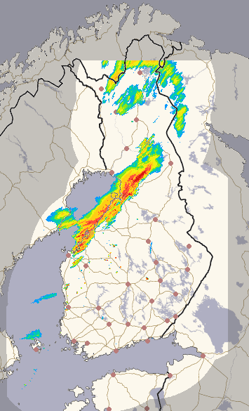
Precipitation in Finland
Select a weather radar from the options at the top. You can stop or start the animation using the Stop/Play button under the image. You can move the animation with a scroll wheel when your mouse pointer is on top of the map. You can also select the image by pointing to a time on the timeline.
Finland 1 h: The image displays precipitation in Finland. Under title "Observations" maps show the hourly accumulated precipitation as measured by the weather radars. Under title "Forecasts" maps are drawn by the meteorologist in duty, using latest information from radars and numerical weather prediction models.
Finland 15 min.: The image displays precipitation intensity in Finland. The composite includes radar echoes also from Norway and Sweden. Lightning flashes from Finland and areas covered by radars from Sweden and Estonia.
