Earth Observation
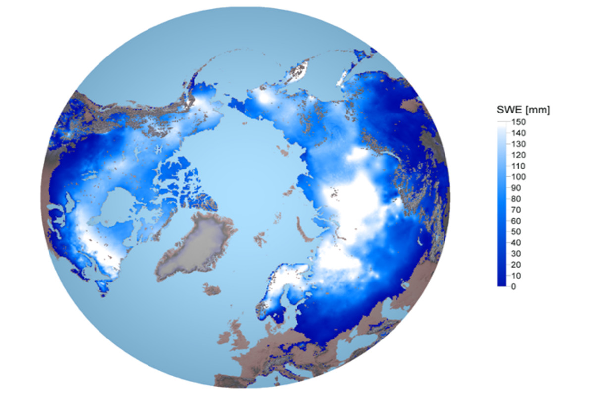
Earth Observation (EO) satellites are essential tools to provide information on the state and processes of the Earth’s atmosphere, biosphere, hydrosphere, and oceans including the anthropogenic impact to environment and climate. EO research at FMI focuses on • UV radiation • Composition of atmosphere: greenhouse gases, ozone, pollutants, aerosols • Cryosphere: snow, sea and lake ice, soil frost
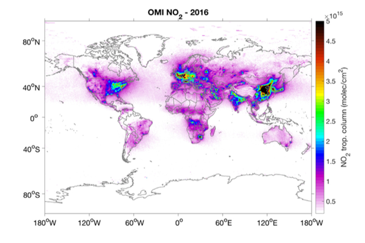
An essential part of the research is the use of satellite data - together with climate modelling and in situ measurement data sets - to investigate and quantify key factors of climate change. Additionally, satellite data is used to develop services and products for various end-use applications such as water resources management and forestry, and monitoring of air pollution, forest fires, volcanic plumes, and floods.
More information on the FMI Space and Earth Observation (EO) research topics on the web pages: Earth Observation Research, Space Research and Observation Technologies and Arctic Space Centre (FMI-ARC), and a larger overview of space and earth observation activities and news on the Space and Earth Observation Centre FMI-SPACE website.
