
August unusually cloudy, the summer cool
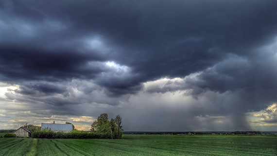 Photo: Raimo Rosholm
According to the Finnish Meteorological Institute statistics, the average temperatures in August were largely close to the usual temperatures. The month was warmer than average only in North Karelia. Due to the general weather situation prevailing in August, the warmest air masses remained south and east of Finland.
August was unusually cloudy in many areas. The effect of cloudiness was seen partly in the highest daily temperatures, which were cooler than usual particularly in the southern and western parts of the country. Nights on the other hand were warmer than usual in most of the country, even unusually warm in North Karelia. The warm nights thus compensated for the impact of the cool daytime temperatures on the average temperature.
The warmest day of the month was on 12 August, when the temperatures widely reached about 25°C in the southern and eastern parts of the country. On that day, the month's highest temperature at Helsinki Airport was reported at 26.0°C. On the same evening, a total of more than 6,000 cloud-to-ground lightning strikes were observed in the southern and eastern parts of the country during the Kiira storm and a lot of wind damage occurred particularly in the regions of Uusimaa and Kymenlaakso.
The monthly rainfall in August was slightly higher than usual in large parts of the country. The highest levels of precipitation were recorded around Kainuu and Northern Ostrobothnia, where the monthly rainfall for August was unusually high in some areas, meaning that it occurs about once every ten years. The month's highest rainfall, 149.5 mm, was measured in Kotila, Puolanka, and the month's lowest rainfall, 43.3 mm, in Rovaniemi.
The summer's highest temperature was measured in Utsjoki
The average temperatures for the summer (June-August) were unusually cool in the southern and central parts of the country. According to the Finnish Meteorological Institute statistics, the average temperature deviated from the usual by more than one degree in many areas. In the northern part of the country, the average temperature for the summer was about 0.5 degrees cooler than usual. The summer was unusually cloudy in many areas, and exceptionally cloudy in Ostrobothnia and Lapland, which partly explains the cool temperatures.
The highest daily temperatures for this summer were on average the sixth coldest since the beginning of the 1960s, which is rather exceptional. The fact that the highest temperature for the summer in the whole country, 27.6°C, was measured in Utsjoki on 28 July also indicates that the summer was peculiar in terms of temperatures. A lower highest temperature for the summer was last measured in 1976.
Hot days with temperatures higher than 25°C were measured somewhere in Finland on a total of 19 days. An equal number of hot days was last measured in summer 2015. The highest number of hot days, a total of five days, was recorded at the airports of both Oulu and Mikkeli. Especially in the central areas of the country, no days with temperatures higher than 25°C were recorded this summer.
Only 29,000 lightning strikes were observed by the end of August, which is an exceptionally low number. Fewer lightning strikes have only been recorded in 2015.
Rainfall for the summer was generally speaking close to the usual levels, but as is typical in summer, there was wide local variation in precipitation. Unusually high levels of precipitation were recorded particularly in Northern Lapland.
Further information:
Weather statistics from the Climate Service tel. 0600 1 0601 (€4.01/min + local charges)Weather forecasts from the meteorologist on duty 24/7 tel. 0600 1 0600 (€4,01/min + local charges)http://ilmatieteenlaitos.fi/ilmastohttp://www.ilmastokatsaus.fi/