A new method recognizes icebergs from satellite images

Icebergs can be treacherous for marine traffic and information on the location of icebergs enhances the safety of seafaring. The novel method, developed by FMI, tackles some of the issues that come with automated recognition of icebergs from images.
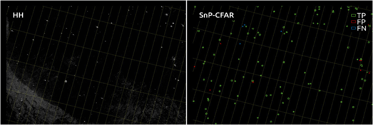
The novel method was tested by comparing its results to the icebergs found in 14 SAR satellite images visually identified by the FMI's ice service experts. The method detected the targets, identified as icebergs by experts, with around 80 % accuracy.
The research area was around Greenland and its southern water areas. In the area, there are plenty of icebergs that have been let loose from the Greenland's continental glacier and are now drifting southward.
More information:
Research Scientist Juha Karvonen, Finnish Meteorological Institute, tel. +358 50 364 3888, juha.karvonen@fmi.fi
Juha Karvonen, Alexandru Gegiuc, Tuomas Niskanen, Anni Montonen, Jørgen Buus-Hinkler (DMI), Eero Rinne. Iceberg Detection in Dual-Polarized C-Band SAR Imagery by Segmentation and non-Parametric CFAR (SnP-CFAR), IEEE Trans. On Geoscience and Remote Sensing, 2021. https://doi.org/10.1109/TGRS.2021.3070312
