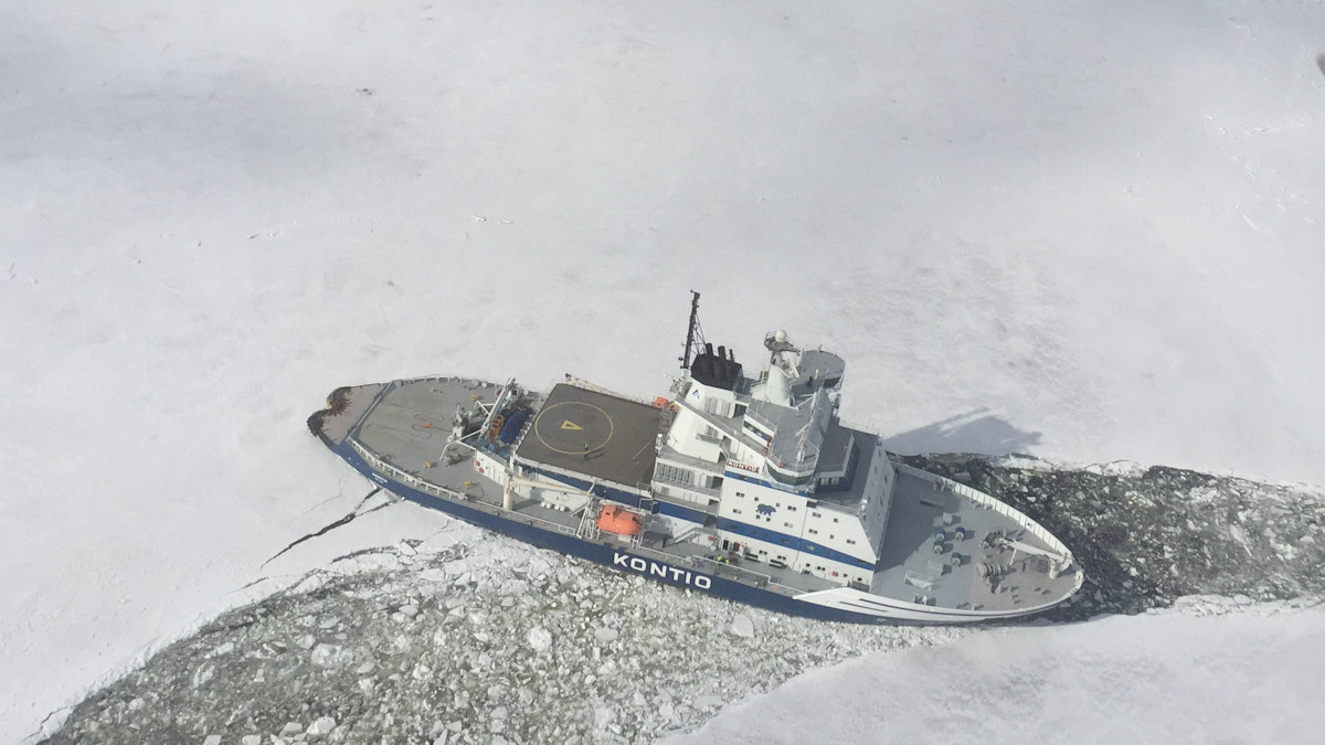
The Arctic Space Centre in Sodankylä guides icebreakers and focuses on climate research

Four large plate antennas are turning in the middle of the pine forest. They are reaching towards the overflying satellites.
The plate antennas are part of the Finnish Meteorological Institute’s research station in Sodankylä, and the Sodankylä Geophysical Observatory of the University of Oulu is located next door. The city centre is a few kilometres away, and the place is aptly called Tähtelä [tähti is a star in Finnish]. After all, this is where people look at the sky.
‘Sodankylä is a special place. It represents the entire coniferous forest area in the north,’ says Jyri Heilimo, Head of Unit at the Arctic Space Centre.
The research station in Sodankylä is officially called: the Arctic Space Centre.
Remote sensing
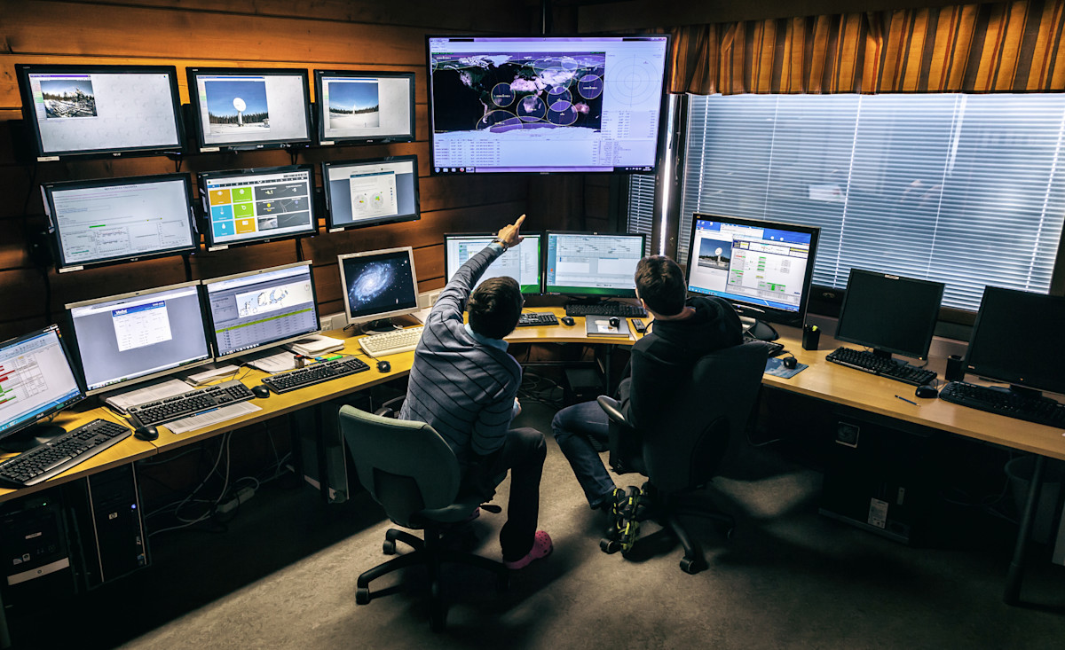
One of the most important tasks of the Sodankylä research station is to act as a ground station for satellites.
Satellites are used to monitor all sorts of things. Especially, of course, weather: cloudiness, temperatures and atmospheric pressures. In addition, icebreakers operating in the Finnish sea areas receive up-to-date information on the ice situation through the Sodankylä station.
‘For society at large, it is also important that the satellites are used to assess, for example, the amount and water equivalent of snow. This can be used to anticipate the flood risk of rivers in spring, and the information is also helpful for hydropower companies,’ Heilimo says.
Research has been carried out in Sodankylä for a long time. Researchers have measured temperatures in the area since the beginning of the century, and the Finnish Meteorological Institute has conducted atmospheric measurements since 1949. A coherent series of temperatures has been measured since 2008.
Furthermore, the station is doing more than catching data on overflying satellites. Snow monitoring is done in winter: depth, moisture, ground frost. Likewise, the exchange of greenhouse gases from vegetation and soil, and the flow of carbon dioxide in the northern coniferous forest are studied as part of the joint European ICOS network that measures greenhouse gases.
‘We also conduct research into intelligent transport, among other things. Sodankylä Airport has a test track for self-driving cars, and we have a good 5G network for that purpose,’ says Heilimo.
Indirect measurements
The most visible activities at Sodankylä research station, however, involve the plate antennas and the dozens of satellites they have reached.
Satellites are important for weather forecasts and climate research, but their use requires knowledge, research and interpretation. Satellites can measure temperatures from orbit only indirectly.
Yet satellite measurements are needed for climate research, as continuous measurements cannot be carried out in every corner of the planet. That is their great advantage. In Sodankylä, efforts are being made to make satellites more reliable.
‘One important task is to ensure that satellite measurements correspond directly with measurements made on the ground,’ says Heilimo.
Firstly, the characteristics of satellites and data must be well known. Secondly, good measurements are needed against which the satellite data will be compared. This information makes it possible to calibrate and fine-tune the satellite measurements, which helps to improve weather and climate research.
‘As we also carry out high-quality climate measurements on the surface of the Earth, Sodankylä is a very representative place in this type of research. The northern coniferous forest zone covers a large part of the planet’s surface,’ Heilimo says.
Tight community
Jyri Heilimo visits Sodankylä regularly. His goal is to be in the north one week a month to meet his team.
‘We have a tight work community here and the atmosphere is laid-back. It is also nice to spend time outdoors or go swimming in the garrison’s swimming pool. It is good to ski here in the winter because this place is certain to have snow’, Heilimo says.
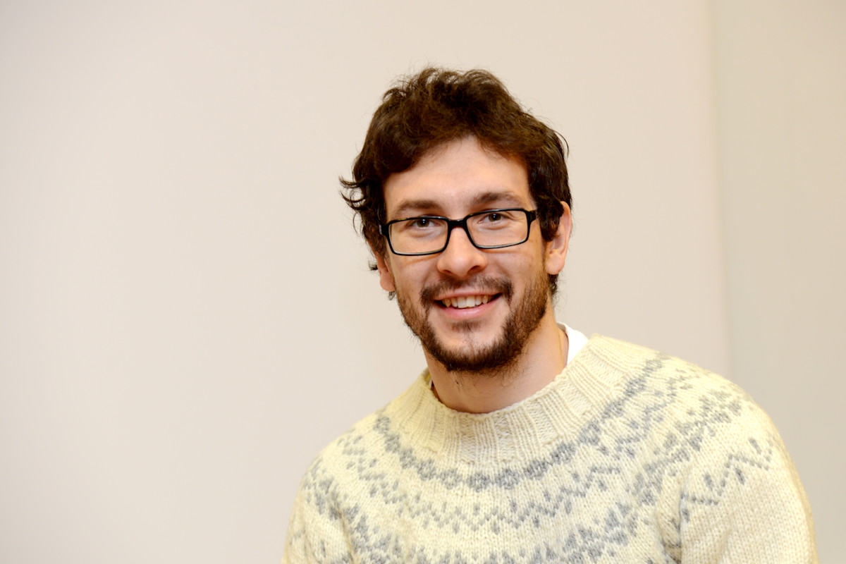
Half of Heilimo’s employees work in Helsinki. The station has 25 permanent employees. Group Manager Timo Ryyppö is one of them, now based locally. He studied meteorology at the University of Helsinki and ended up doing a traineeship in Sodankylä by chance. The exotic summer posting continued until the end of the year, and Ryyppö never looked back.
‘Now I have already established a family here. The work is diverse, which is why I probably stayed here in the first place,’ says Ryyppö.
Ryyppö works as the head of a group of ten people at the Sodankylä research station. The work responsibilities include overseeing the operations of the ground station and planning the group’s tasks, but there truly seems to be a lot of variation.
For example, one Saturday in December, Timo Ryyppö’s phone was ringing. One of the plate antennas in Tähtelä was not working properly. Ryyppö jumped into his car, climbed up the ten-metre antenna in the freezing temperature and calibrated the antenna.
‘Last Saturday I got to do it three times,’ says Ryyppö.
This is ‘voluntary on-call service’. The next day you get to sit in meetings and plan funding. On other days, the group manager codes, maintains or cleans the antennas from snow. In other words, he does everything the 10 employees in his group do. Taking care of the satellite receivers and the data they capture.
From space to icebreakers
Ryyppö’s most important task is to ensure that the data can be captured from the overflying satellites and delivered to the recipients after being processed correctly.
The scheduling of overflights is one of the most important tasks of the day, as one plate antenna can only follow one satellite at a time.
Most of the satellite data received by Ryyppö’s group is used by the Finnish Meteorological Institute for weather reports, monitoring of snow or forest fires, or other purposes. One third of the satellite readings is delivered to ‘customers’, including the European Space Agency (ESA), European Organisation for the Exploitation of Meteorological Satellites (EUMETSAT) and the US-based National Oceanic and Atmospheric Administration (NOAA).
‘We pass on information to internationally important research organisations, and we can cover our costs by selling the services offered by our station,’ says Ryyppö.
Some customers want the data directly, as raw data, for research purposes or similar. It is a good idea to process the data for faster transfer. Sodankylä’s computer room is large and there is more data than the fibre optic cables could transport. It is often a good idea to transfer a finished product because it will run faster.
Sometimes the processing of data involves a lot of work. For example, if satellite information was to be sent directly to the icebreakers, it would be of little use to the pilots.
‘We need to present the number ones and zeros in a useful format. This requires a lot of processing,’ says Ryyppö.
Perfectly placed in the north
Sodankylä is an excellent place for a satellite station.
‘We are 100 kilometres north of the Arctic Circle, and, at these latitudes, there are not that many satellite ground stations with the same capacity in the world,’ says Jyri Heilimo.
The four antennas in Sodankylä capture data from up to 100 satellite overflights per day. Satellite data can only be read if the satellite is ‘in sight’ of the antenna.
‘As we are closer to the North Pole, we get more overflights every day simply for geometrical reasons. There would be fewer in the latitudes of Helsinki,’ says Timo Ryyppö.
The Tähtelä community is based around the centre of Sodankylä, but still slightly apart. Together, the University of Oulu and the Finnish Meteorological Institute are among the largest employers in the municipality. According to Heilimo, cooperation with the municipality of Sodankylä is going well.
‘In the eyes of the locals, though, we probably fulfil the stereotype of strange researchers here in Tähtelä,’ Timo Ryyppö laughs.
