New methods to estimate rainfall and how icing affects wind energy
Observational datasets are an important part in today's meteorological developments. For example, surface observations are very useful as they are but they only provide weather information for a point location, they do not give much information, if any, on what happens between the observation stations across a larger area. On the other hand, using models, one can create an analysis of the meteorological situation, i.e. calculate and estimate what happens between fixed observation points. Remote-sensing data, such as radar and satellite, are being processed and the output is given over a domain as an analysed product of their measurements. For example, radar gives a plot of where the rain is located, i.e. an analysis of the current precipitation.
Wanting to improve the present algorithms and their functionality on how to perform the meteorological analysis, Erik Gregow did his research work using the Local Analysis and Prediction System (LAPS) for his doctoral dissertation at the University of Helsinki. He used different kinds of meteorological observations and studied their interdependencies in order to combine and merge information from various instruments. The LAPS developments were used for several end-users (FMI duty forecasters, SYKE) and nowcasting applications (road and fire weather models).
"My primary focus has been to improve the estimation of hourly precipitation accumulation and meteorological quantities that affect wind energy production", says Erik Gregow, who is working at the Finnish Meteorological Institute.
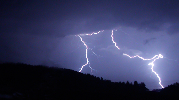
Lightning data improved the rainfall estimates
Erik Gregow's studies were concentrated on Finland area and according to his results one can improve the precipitation amount estimations by combining surface station measurements, radar and lightning information.
"Combining radar and surface observations gives a clear improvement when estimating the accumulation product. The use of lightning data can further help in the calculations and gives the advantage of having additional data outside radar coverage, which can potentially be very useful for example over sea areas", says Gregow.
In addition, the improved LAPS analyses for cloud-related quantities and a newly developed model, called LOWICE, makes it possible to calculate the electricity production during wintertime.
Here, the icing on wind turbine rotor blades result in reduced power production. This is an important aspect for the wind energy industry where the energy production needs to be estimated ahead, before being sold on electricity market. There is also a safety aspect, big pieces of ice can fall from the rotor blades and potentially hit the staff and damage facilities.
"Here in our northern areas, the wind power turbines are sensitive to icing and thereby the cut down in produced energy. We have shown promising results where we are able to model the power losses, induced by the icing", he says.
Short-term forecasts,"nowcasts", and predictability difficulties
With a series of radar images, a person or a computer can process information to estimate where the rain will move and be located within the next few minutes or even hours, i.e. a short forecast also called "nowcast".
"For most quantities, such as temperature and wind, it is still significantly harder to make such a nowcast, since they are influenced by many other meteorological factors and there is no linear development of them", says Erik Gregow.
Therefore, forecast models are needed to solve the involved physical and dynamic equations even at these short forecast time ranges, similar as for estimating the weather for several days ahead.
A prerequisite for generating a forecast of high quality is to capture the initial weather conditions as good as possible. This is done using observations and they are introduced into the forecast model through different techniques, where the model creates its own analysis as the initial step. But there still remain problems with the first hours of the forecast, since the model dynamics are not in balance initially, and therefore there is a "spin-up" until these are being stabilized.
"There is still much work needed on how to improve the first hours of the forecast, especially since the forecast models nowadays operates at higher resolutions (that is resolving the weather at smaller scales). Here, the analysis part is essential and needs further developments", says Erik Gregow.
Link to thesis: (http:// https://helda.helsinki.fi/handle/10138/229598)
More information:
Erik Gregow, tel. +358 50 320 7859, erik.gregow@fmi.fi
