
Tervalamminsuo
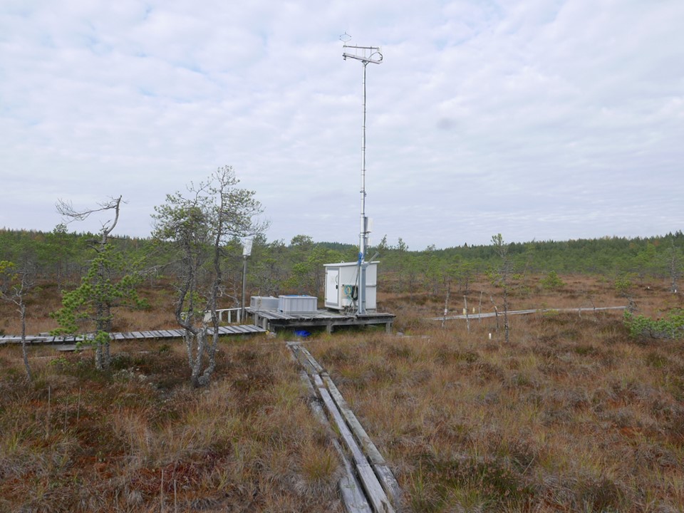
Coordinates: N60°38.734' E23°58.320' Altitude (m.a.s.l): 117 Ecosystem type: Bog
Observations
CO₂-flux (EC at 7 m since 06/2012)
Supporting environmental data: Air temperature, air humidity, soil temperature, soil heat flux, soil moisture, water level height, PPFD, global radiation, albedo, net radiation, long-wave radiation
Climatology
Climate data point (Somero 8km): FMISID: 101128, WMO: 02949 Average temperature (°C): 5.3 Annual precipitation (mm): 640 Average snow depth at mid-March (cm): 28 Median period of snow cover: Dec 13 – Apr 8
Environment
Vegetation type: Ombrotrophic bog Area to the west of the EC-mast: sparsely treed (Pinus sylvestris) Sphagnum fuscum bog Area to the east and south: ridge-hollow pine bog Typical species: Ledum palustre, Calluna vulgaris, Andromeda polifolia, Empetrum nigrum, Rubus chamaemorus, Eriophorum vaginatum, Sphagnum spp. Mean veg. height (m): Field layer 0.05-0.10 m, tallest trees ~7 m on the Sphagnum fuscum bog Max projected LAI: - Soil type: Peat; poorly humified Sphagnum-peat Stand volume (m³ ha⁻¹): - Tree density (ha⁻¹): - Tree age (years): -
6.7.2022