
Sodankylä forest
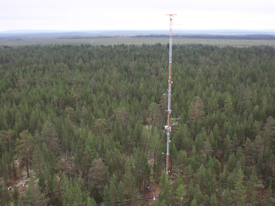
Coordinates: N67°21.708', E26°38.29' Altitude (m.a.s.l.): 179 Ecosystem type: Scots pine forest; Uliginosum-Vaccinium-Empetrum (UVET) type Networks: CryoNet station of GCW Station web-page: Sodankylä Arctic Research Centre
Observations
CO₂ and CH₄ concentrations (at 48 m), additional gradient levels (2, 23, 48 m since 06/2012)
CO₂ flux (EC at 22.5 m since 01/2000)
CO₂ flux (EC below canopy at 2 m 01/2006-??)
CO₂ flux (manual chamber, forest floor 2003-2005, growing season)
CO₂ flux (EC at 22.5 m since 09/2012, N67°21.71', E26°38.59')
Supporting environmental data: Air temperature + humidity, soil temperature, soil heat flux, soil moisture, PPFD, global radiation, albedo, net radiation, boundary layer Doppler-lidar
Climatology
Climate data point: FMISID: 101932, WMO: 02836 Average temperature (°C): 0.3 Annual precipitation (mm): 542 Average snow depth at mid-March (cm): 75 Median snow cover period: Sep 26 - May 14
Environment
Vegetation type: Pinus sylvestris; forest floor: e.g. lichens, mosses and small shrubs Mean vegetation height (m): 12 Max projected LAI: 1.2 Soil type: Sandy podzol Stand volume (m³ ha⁻¹): NA Tree density (ha⁻¹): 2100 Tree age (years): 80-180
7.7.2022