
Satellite and radar applications
Satellite observations are nowadays routinely used in weather forecasting and climate research, as visual aids for forecasters, as input information for the weather models, and as data sources against which climate models may be compared. Part of the information in satellite observations describes the state of the atmosphere such as: cloud cover, water vapour, aerosols (such as volcanic ash), trace gases, as well as wind speed and direction. Many satellite observations also characterize the surface conditions of the globe: surface temperature, surface albedo, snow cover, glaciers, sea ice, wave height, pollution of water (such as oil spills), soil moisture, biomass, leaf area index, forest or brush fires etc.
FMI participates in and contributes to EUMETSAT Satellite Application Facility (SAF) projects CM SAF and H SAF. CM SAF focuses on the provision of satellite-based data in support of climate research of the Earth’s water and energy cycles, whereas H SAF focuses on provision of satellite-based data to support hydrological research.
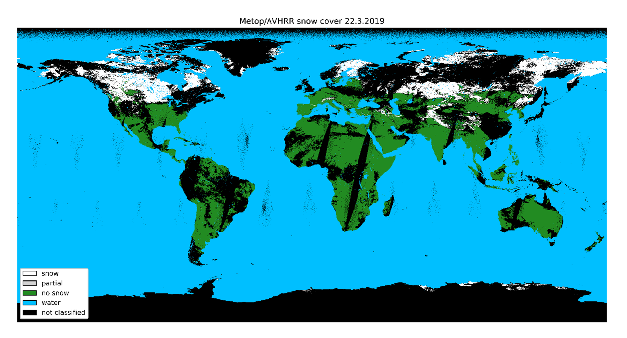
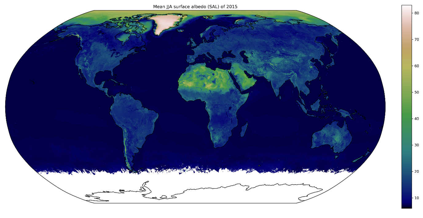
In CM SAF, FMI is responsible for the provision of a global surface albedo dataset, based on polar-orbiting weather satellite observations from NOAA POES and EUMETSAT METOP series of satellites carrying the AVHRR imager. In H SAF, FMI develops a variety of datasets describing the extent and properties of both European and global seasonal snow cover. Our team actively develops state-of-the-art algorithms towards these ends, taking advantage of advances in e.g. machine learning.
Another important focus area for the group is the application of multi-source Earth Observation data for cryospheric research, particularly in the detection and attribution of trends. This work is presently concentrated in several research projects funded by the Academy of Finland; CRYO-TREC (2017-2021) studied the representation and trends of Arctic seasonal snow cover in satellite observations and CMIP6 climate models, SNOCAP (2021-2025) focuses on developing novel restraints and estimates of Arctic precipitation (rain, snow, rain-on-snow) from multi-source indirect satellite observations, and LAS3R (2021-2024) seeks to improve our understanding on surface roughness of Antarctic snow and sea ice cover, and its influence on satellite observations of e.g. Antarctic sea ice freeboard. A key part of the LAS3R project is in situ measurements of snow/ice surface roughness, to be collected at the Finnish Aboa research station in Antarctica.
30.9.2021