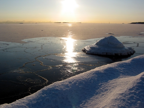
The ice season 2004/2005 was average
When classified by the extent of the ice cover, the ice season 2004/2005 was average.
In all maritime areas, with the exception of the Bay of Bothnia, winter began noticeably earlier than average, in the end of November, but most of the thin ice layer melted due to the mild weather in December and January. A more extensive ice cover did not begin forming until the middle of February.
The northern Bay of Bothnia began to freeze half-way through November, about a week later than average. Freezing in the southern part of the Bay of Bothnia started as normally, toward the end of the month. At the same time, ice also began forming on the Bothnian Sea, the Archipelago Sea and the western Gulf of Finland, about a month earlier than average, and in the eastern Gulf of Finland, about 2 weeks earlier than average.
The weather grew milder in early December, and the ice situation declined. The majority of the thin ice layer around the archipelagic areas of the southern Bothnian Sea, the Archipelago Sea and the middle and western Gulf of Finland melted away during the month of December. In the northern Bay of Bothnia, the ice remained north of the Kemi II and Oulu I line. The weather grew slightly colder in the end of December and new ice formed around the archipelagos in the Bothnian Sea, the Archipelago Sea and the Gulf of Finland. In the northern Bay of Bothnia, the ice edge reached the line Kemi I - Oulu I - Raahe lighthouse.
The January weather was mild until the very end of the month. The cold weather at the end of the month caused the ice layer to grow, covering the largest part of the Bay of Bothnia, with an ice layer being formed in the Quark. In the Gulf of Finland, the ice layer reached the Kotka – Seskar line.
February started with mild weather, and the ice situation declined. In the Bay of Bothnia, the ice accumulated inside Kemi I and Oulu I. New ridges were formed between Kemi I and Kemi II. The arrival of colder weather in the middle of February caused ice to form in all maritime areas. The Bay of Bothnia was totally covered with ice on the 24th of February, over a month later than average. At the end of February, the ice edge in the Gulf of Bothnia ran from out of Sundsvall to about 30 nautical miles south of Sydostbrotten and further to Storkallegrund, and from there about 15 nautical miles west of the Rauma lighthouse, and to Åland. The Archipelago Sea was frozen, and the ice layer in the Gulf of Finland reached the Bengtskär – Pakri line.
The beginning of March was still cold, producing more ice. The largest ice cover – 178 000 km² – was reached on the 16th of March. The Bay of Bothnia was completely covered by ice at this time. Partial open water area in the Bothnian Sea reached from Finngrundet to out of Sundsvall. The Sea of Åland, the Archipelago Sea and the Gulf of Finland were covered by ice. The ice edge in the northern Baltic Sea was situated along the line Söderarm – Bogskär – Tahkuna, the Gulf of Riga being frozen. The ice conditions began declining shortly after this.
In the Northern Baltic Sea the ice broke up toward the end of March, about a week earlier than average. In the Bothnian Sea, the Archipelago Sea and the Gulf of Finland, the ice broke up at the end of April, in normal time. The Bay of Bothnia became clear of ice at the end of May, slightly earlier than average.
The maximum thickness of fast ice in the northern Bay of Bothnia was 45 to 70 cm, in the Archipelago Sea 25 to 30 cm, in the Western Gulf of Finland 40 cm and in the Eastern Gulf of Finland, 45 to 55 cm. In open sea areas the ice was 20 to 45 cm thick in the Bay of Bothnia, 5 to 20 cm in the Bothnian Sea, 5 to 15 cm in the western Gulf of Finland and 20 to 40 cm in the eastern Gulf of Finland.
The duration of the ice winter was shorter than average in all maritime areas; in the Bay of Bothnia about 2 weeks, in the Northern Baltic Sea about a week, in the Archipelago Sea and the archipelagic areas of the Bothnian Sea and the Gulf of Finland slightly under average, and in the open sea areas of the Bothnian Sea and the Gulf of Finland about a month shorter than average.
Simo Kalliosaari