
The National Satellite Data Centre offers satellite data for free and as a cloud service
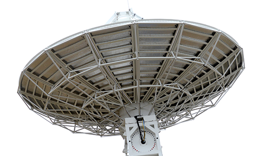 Photo: Tero Pajukallio
Sodankylä receives and archives satellite observations of Finland, Europe and the northern hemisphere. Satellites can be used to tailor different products for different needs. Important user groups are, for example, environmental and safety officials. The information transmitted by satellites can be used also in meteorological services, flood prediction systems, ice services and shipping. "The information received from satellites makes it possible to prepare for natural disasters and dangerous situations caused by weather and climate more efficiently", says research professor Jouni Pulliainen from the Finnish Meteorological Institute.
Endless possibilities for application developers
Satellite data received in Sodankylä is available as open data, and if used by a wider user group, it could be used more efficiently than today. As the satellite data is also available as a cloud service, it offers unlimited possibilities for application developers and entrepreneurs. "This offers endless possibilities for product and service development and to create new ecosystems and partnerships between private and public sectors", emphasises research professor Jouni Pulliainen.
FMI uses the received satellite data in several ways. Satellite images can be tailored to produce different kinds of products, like ice charts, flood prediction maps, UV-products and snow and ground frost maps. Satellites are also used to provide environmental and safety information for long-term monitoring. This is important especially in the northern areas, where the effects of climate change can particularly be seen.
The collaboration partners of the Sodankylä satellite data centre are Eumetsat, the European Space Agency and the EU's Copernicus programme. The Sodankylä satellite data centre has an ideal location to receive data from polar orbiting satellites, i.e. satellites with an orbit passing above the poles. As Sodankylä Satellite Data Centre receives data from several satellites and it has an extensive ground measurement program to verify the accuracy and reliability of the satellite measurements, it further enhances the cooperation with different partners.
More information:
Research professor Jouni Pulliainen, +358 50 589 5821, Jouni.pulliainen@fmi.fi
Watch a video from Sodankylä: https://youtu.be/W71HnVR7tHs
Sodankylä National Satellite Data Center: nsdc.fmi.fi